Securing mining’s future: Inspiring the next generation of responsible resource leaders
by Ben Lepley
View post

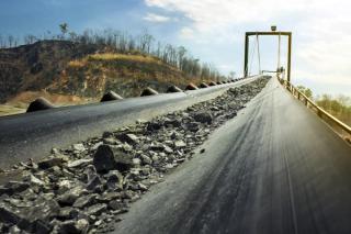
Mining operations inevitably reshape the landscape. As the industry pivots toward sustainable closure practices, the challenge lies not just in reshaping mined land—but ensuring it remains stable, self-sustaining, and safe for decades to come. One of the most persistent risks is erosion, which, if left unmanaged, can undermine landform integrity, degrade water quality, damage infrastructure, and hinder rehabilitation success.
In Queensland, the Progressive Rehabilitation and Closure Plan (PRCP) framework mandates that mining proponents demonstrate that rehabilitated landforms will remain stable before land can be declared “available for rehabilitation.” This requires robust, science-based erosion assessments, particularly where slopes intersect with final voids or encapsulate potentially acid-forming (PAF) or dispersive materials.
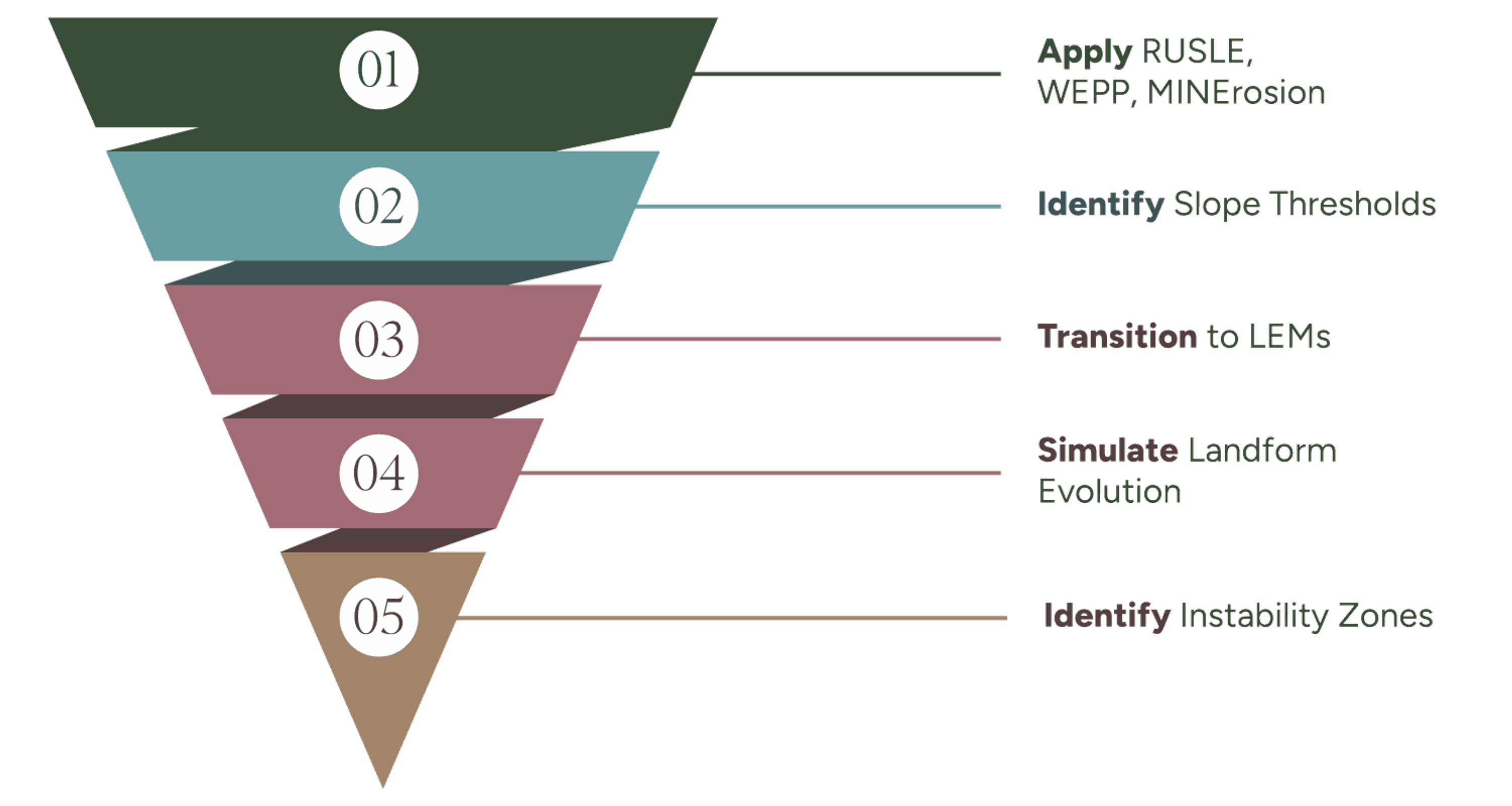
At SLR, we apply a tiered erosion modelling strategy aligned with the mine life cycle. During conceptual design, we use tools such as RUSLE, WEPP, and MINErosion4 to define acceptable slope gradients and lengths, select suitable materials, and identify erosion risk thresholds. As landform concepts progress, we transition to more advanced landform evolution models (LEMs) such as SIBERIA and CAESAR-Lisflood, which simulate surface evolution under real rainfall regimes and vegetation cover over decadal to centennial timeframes. These models help identify gully-prone zones and refine landform geometry before construction.
Numerical models should be developed using measured data to obtain reliable results. Soil erodibility parameters like critical shear stress, rill and inter-rill erosion rates, and runoff coefficients vary widely depending on spoil properties, topsoil conditions, and treatment methods. Relying on literature or assumed values can introduce significant uncertainty.
To address this, SLR utilise a portable Rainfall and Erosion Simulator (RaESIM). Deployed in the field or lab, the RaESIM simulates rainfall at varying intensities and durations, measuring sediment yield, runoff quality, infiltration, and erosion thresholds. The site-specific data generated using RaESIM is then used to parameterise models like WEPP, SIBERIA, and MINErosion, dramatically improving their predictive power and giving stakeholders greater confidence in landform performance forecasts.
SLR supports clients across the full rehabilitation workflow—from landform design and erosion control planning to revegetation, hydrological assessment, and long-term monitoring. Whether at the early design stage or preparing documentation for PRCP certification, our integrated erosion modelling and rehabilitation services ensure closure strategies are technically robust, regulator-ready, and future-resilient.
Reach out to our team for further information, or to discuss how we can help you with your mine closure and transformation objectives.
by Ben Lepley
by Dr. Tecle Rufael, Valeria Alvarado Tejeda
by Danny Jones